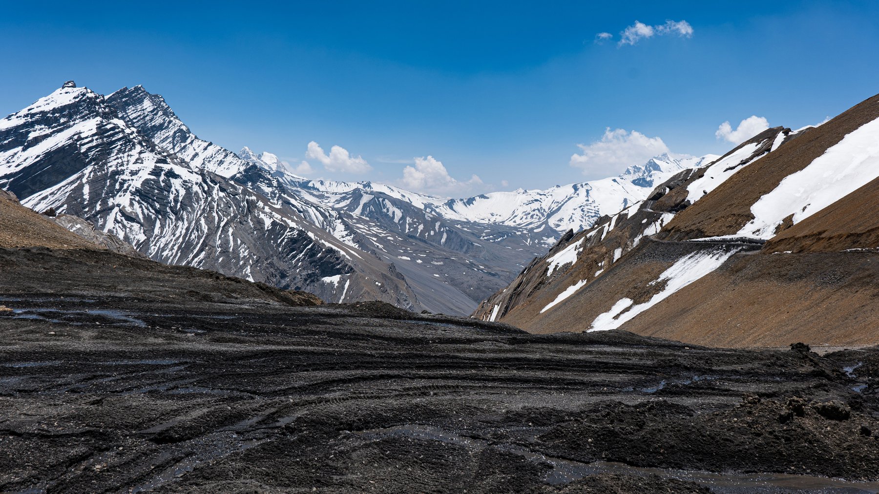
Munsiyari is the road head for one of Kumaon's classic high-altitude treks: the walk up the Johar Valley, along the Gori Ganga river, to Milam village and the glacier that feeds it. It's not a day trip or even a weekend trip — most people give it the better part of two weeks — but for anyone at SamathaStay with the time and fitness for it, it's one of the most historically loaded walks in this part of the Himalaya.
The route from Munsiyari
The trail follows the Gori Ganga north from Munsiyari through a string of villages — Lilam, Bogudiyar, Rilkot, Martoli — before reaching Milam itself, with the glacier a short walk further on. It's roughly 60km one way from Munsiyari to the glacier, mostly through pine and rhododendron forest lower down, then narrower cliffside trail and high-altitude terrain higher up. Most operators run it as a multi-day itinerary of around a week to ten days round trip, and it's rated moderate to challenging — long walking days, some exposed stretches, and enough altitude that acclimatisation matters. This is a trek to book through a registered local operator rather than attempt solo. In its trading days the route continued much further still, over high passes like Unta Dhura (pictured above, around 5,350m) into Tibet — well beyond where a standard glacier trek now turns back, but part of the same old Johar Valley trade road.
A trade town that emptied out
Milam wasn't always this quiet. Into the early twentieth century it was a substantial Bhotia (Shauka) settlement — home to well over a thousand people at points, by some counts the largest village in the area — who spent summers here farming and trading, then moved down to Munsiyari and lower villages for winter. Their trade ran north into Tibet over passes like Unta Dhura: grain, cotton and sugar going up, and salt, wool, pashmina and borax coming back, carried by caravan. Two of the village's residents, Nain Singh and Kishan Singh, went on to become celebrated 19th-century explorer-surveyors, secretly mapping Tibet for the Survey of India disguised as traders and pilgrims.
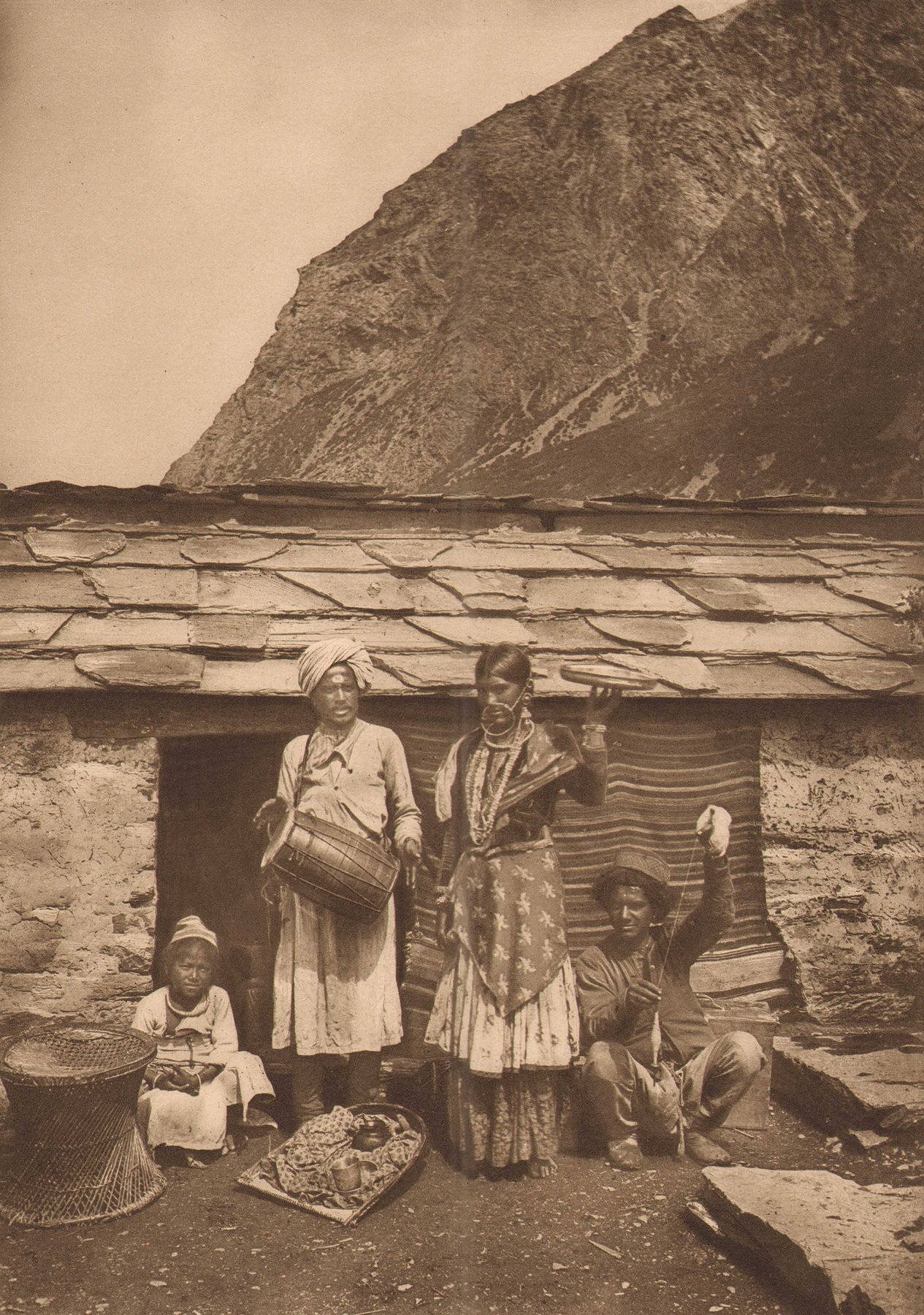
That trade ended abruptly after the 1962 war with China closed the border passes for good. Without the trade that sustained it, Milam largely emptied out — many families resettled permanently in Munsiyari and nearby towns, and today the village is occupied only in the warmer months, by a much smaller number of people growing buckwheat, potatoes and high-altitude herbs. The photograph above, from a 19th-century expedition album, is a reminder of how different the valley looked when this was still a working trade route rather than a trekking destination.
Permits and planning
Because the trail runs close to the Indo-Tibet border, trekkers need an Inner Line Permit, generally arranged in Munsiyari itself through the local administration — a registered trek operator will normally handle this as part of booking the trip. Note too that there's been talk locally of a motorable road being extended further up the valley toward Milam, so it's worth checking current road status with an operator before you plan the trip in detail, since it could change how much of the route is walked versus driven.
Best time to go
Mid-May to mid-June and September to October are generally considered the best windows — clearer trails and more stable weather. The monsoon months of July and August are best avoided, both for slippery, landslide-prone sections of trail and for reduced visibility on what is, for much of its length, a very scenic walk.